UPDATE ON THIS OFFERING, While you can still purchase the complete farm as a unit, the Sellers have decided to also offer the farm as 3 Parcels each parcel will include an irrigation well and irrigated acres.
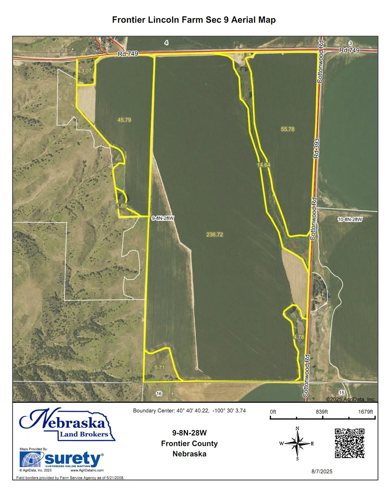
South Parcel: All that land in Section 9 and irrigation well #4.
ACRES: 379.13 taxed acres
Irrigated Acres: 290 Middle Republican NRD Certified Irrigated Acres
LIST PRICE: $1,900,000.00
East Parcel: All that land in Sections 2 & 3 and irrigation well #3.
ACRES: 798.67 taxed acres
Irrigated Acres: 340 Middle Republican NRD Certified Irrigated Acres
LIST PRICE: $4,100,000.00
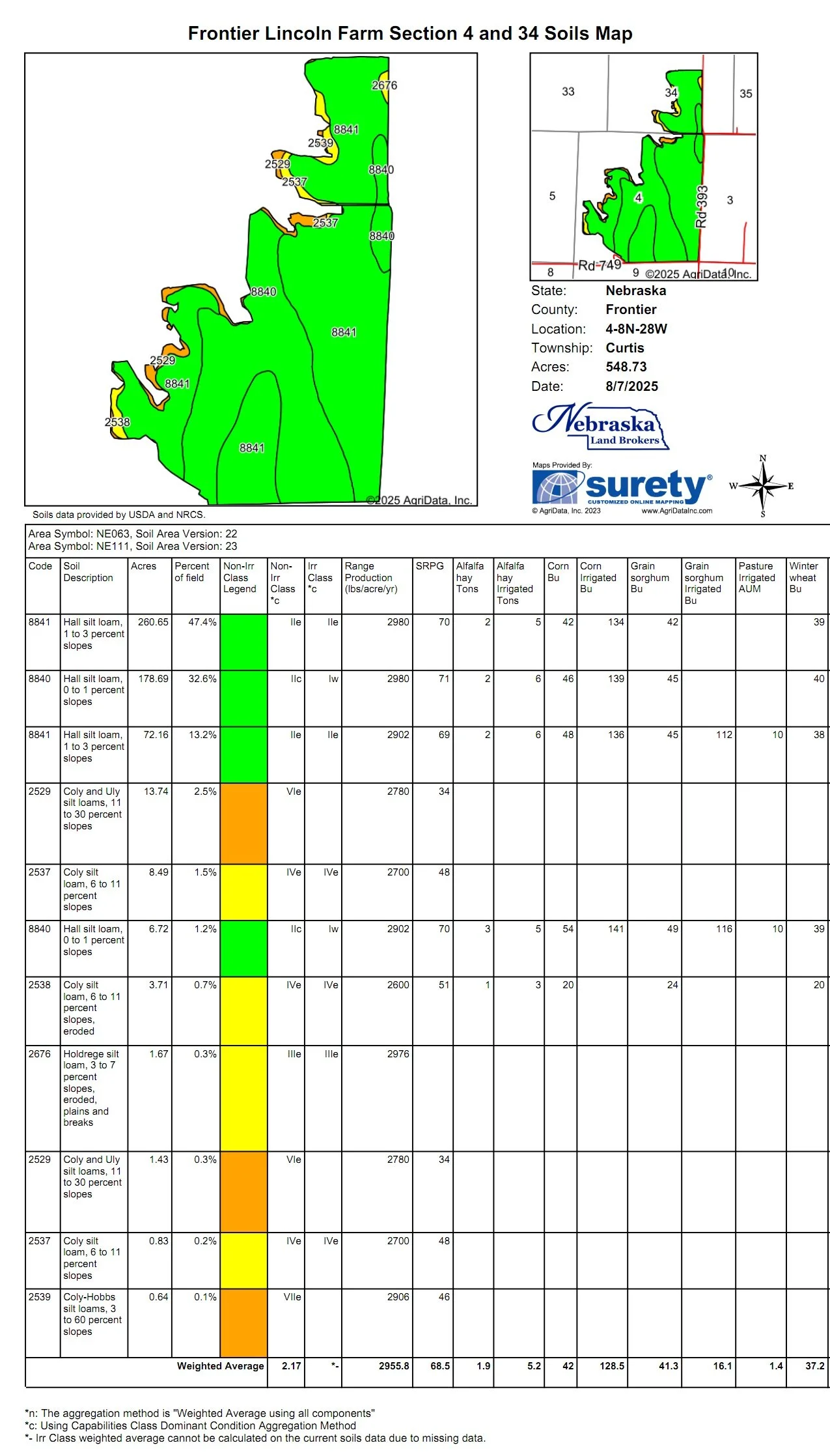
West Parcel: All that land in Sections 4, 33 & 34 and irrigation wells #1 & 2.
ACRES:900.98 taxes acres
Irrigated Acres: 511 Middle Republican NRD Certified Irrigated Acres
LIST PRICE: $5,200,00.00
If you would like ot purchase all 2,077.89 acres of the offering here is a link to the whole farm listing:
INTERACTIVE AREA MAP
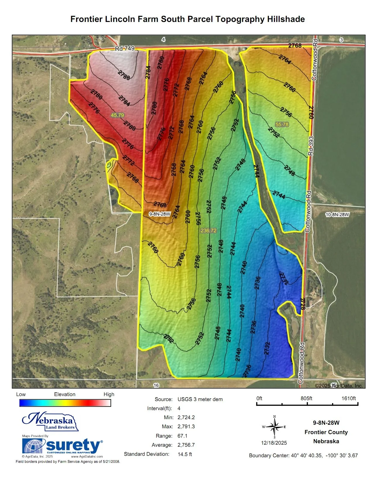
SOUTH PARCEL INFORMATION
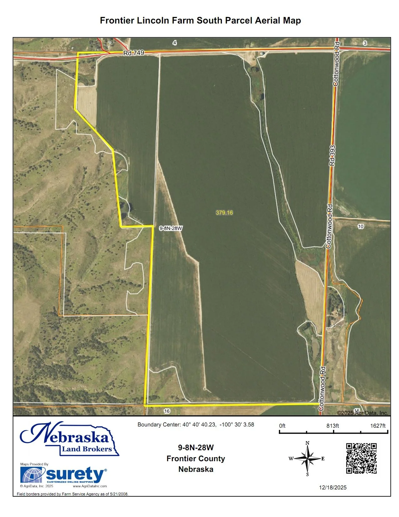
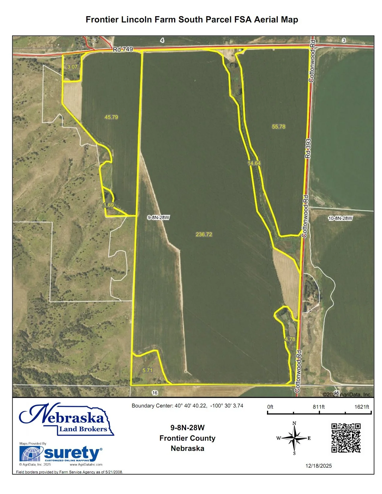
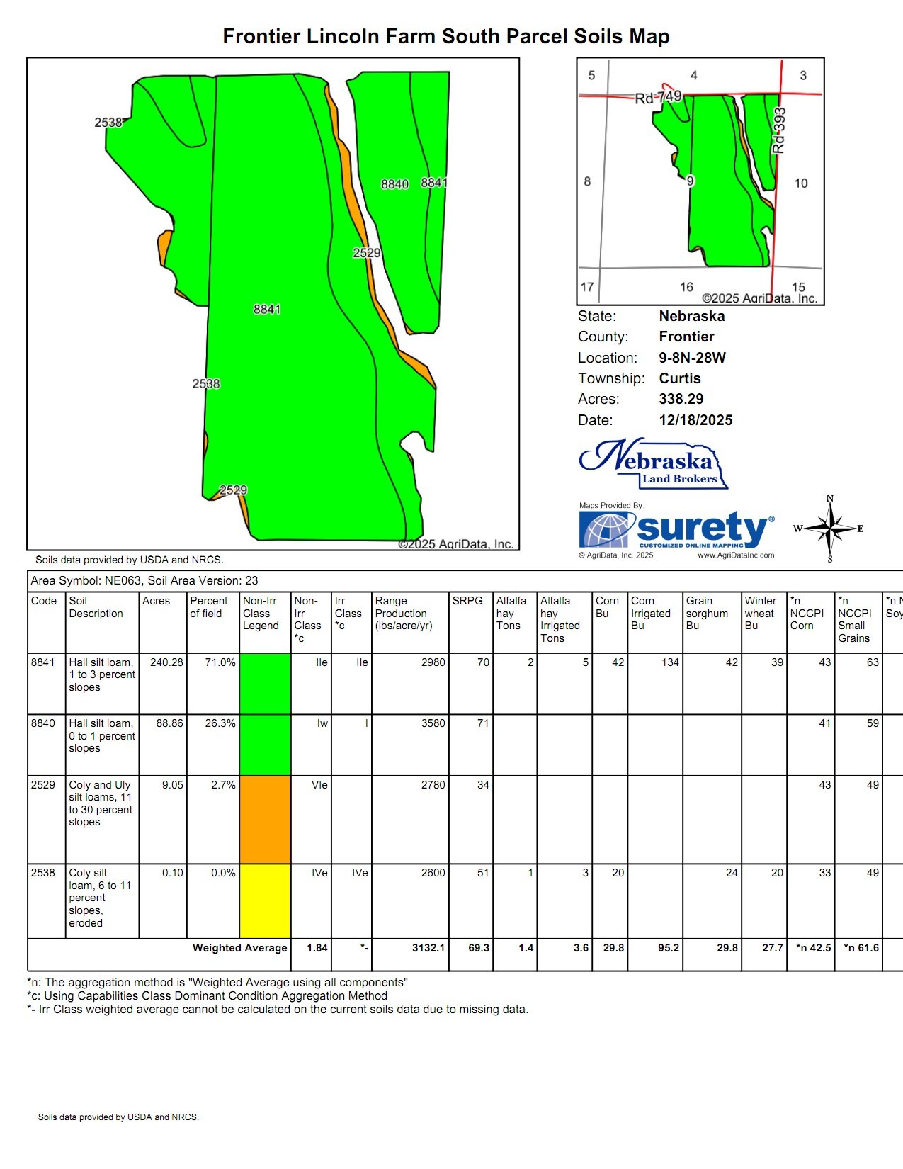
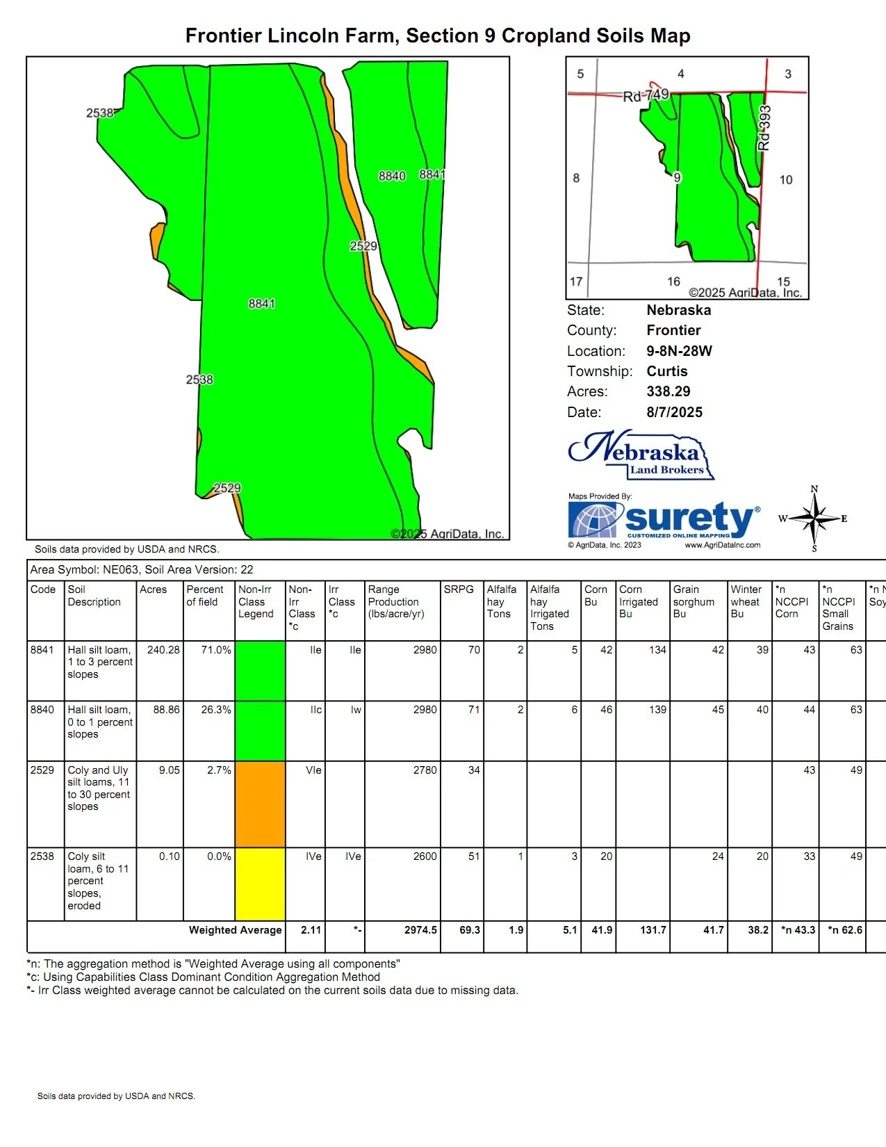
The South Parcel is all that land in Section 9-T8N-R28W of the 6th P.M., Frontier County NE. and includes 379.13 taxed acres. There is County Road access on the east and north.
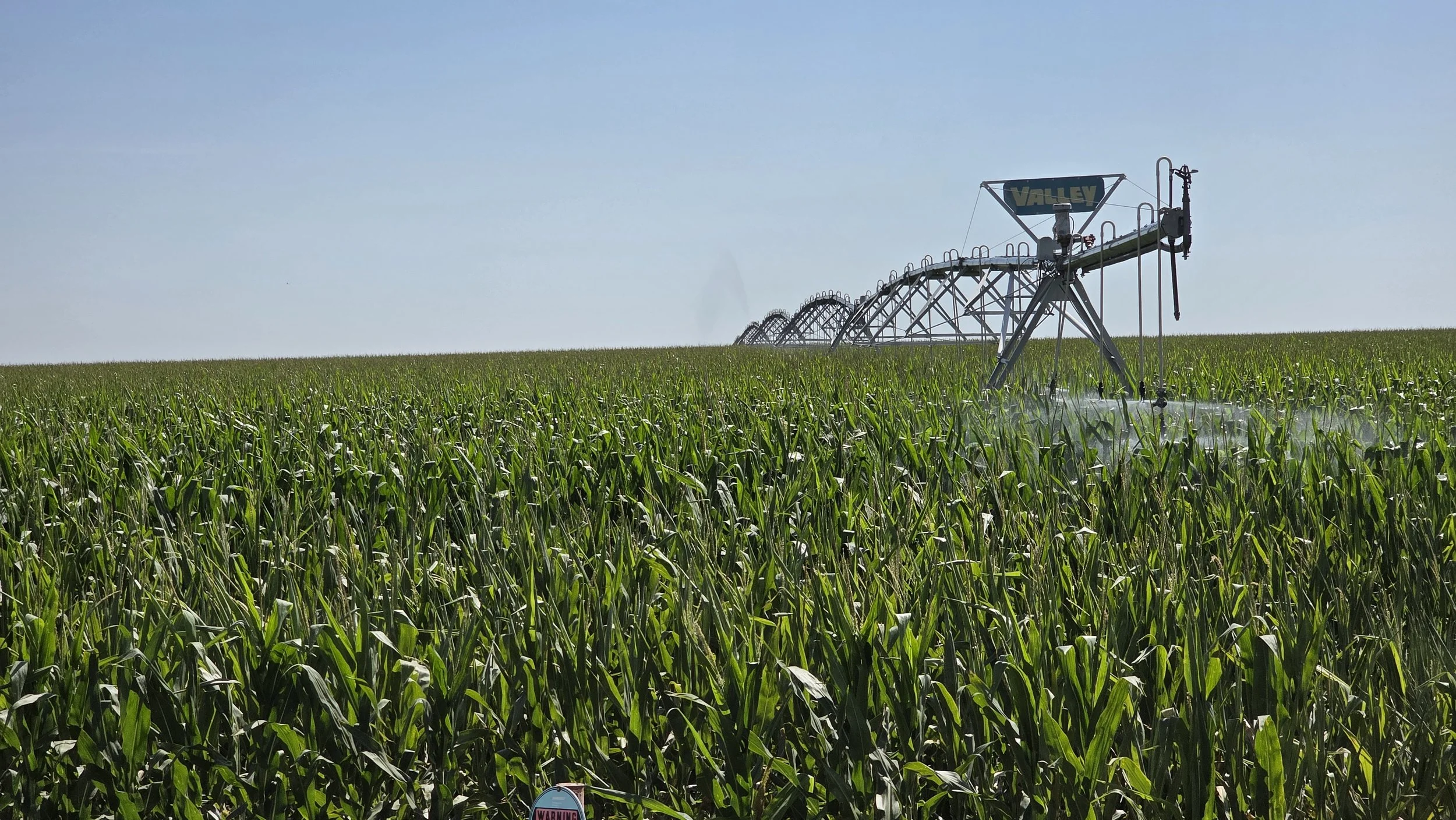
Gravity Irrigated Cropland in Section 9
There are 290 Middle Republican NRD certified irrigated acres in the Parcel. This Parcel will be offered with Well #4 of the Ownership. All of the certified irrigated acres are currently irrigated as gravity with gated pipe.
Well #4 Registration # G-061556, drilled in 1979 to 498’ deep; static water at drilling 197’; pumping level at drilling 280’; pumping 2,200 gpm at drilling. 11” well with Sargent irrigation pump set by Sargent Irrigation October 10, 2012 set at 340’. GE 200 HP electric motor, Micrometer flow meter 19-08894-10 indicated 1,636 gpm on July 29, 2025. Sargent Irrigation in Grant overhauled pump in October 2012. An pumping efficiency test was completed September 8, 2025 and the results of that test are available below.
Irrigation Well #4
The irrigation well is located across the road to the north in the SE1/4 of Section 4. A well use agreement would be put in place for the use of this well for the life of the well.
The terrain of the cropland is conducive to the development of 2 standard center pivot irrigation systems upon it. The Parcel does include a small grain bin.
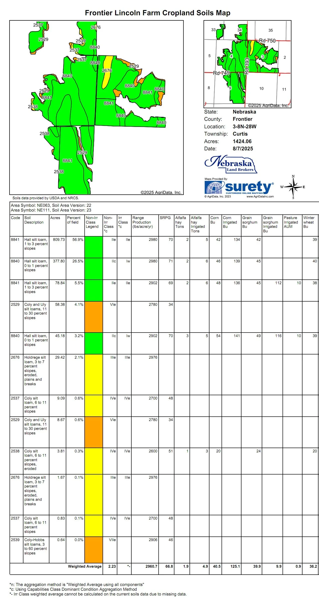
The cropland soils are nearly 98% Class I & II Hall silt loams with 0-3% slopes.
Acres: 379.13 taxed acres
MRNRD CIAs: 290 irrigated acres
Gravity irrigated cropland in Section 4
Real Estate Taxes: 2025 real estate taxes are $13,375.00
MRNRD Occupational Taxes: $2,900
Legal Description: Township 8 North - Range 28 West of the 6th P.M., Frontier County, NE
Section 9: E1/2 and Part NW1/3
LIST PRICE: $1,900,00.00
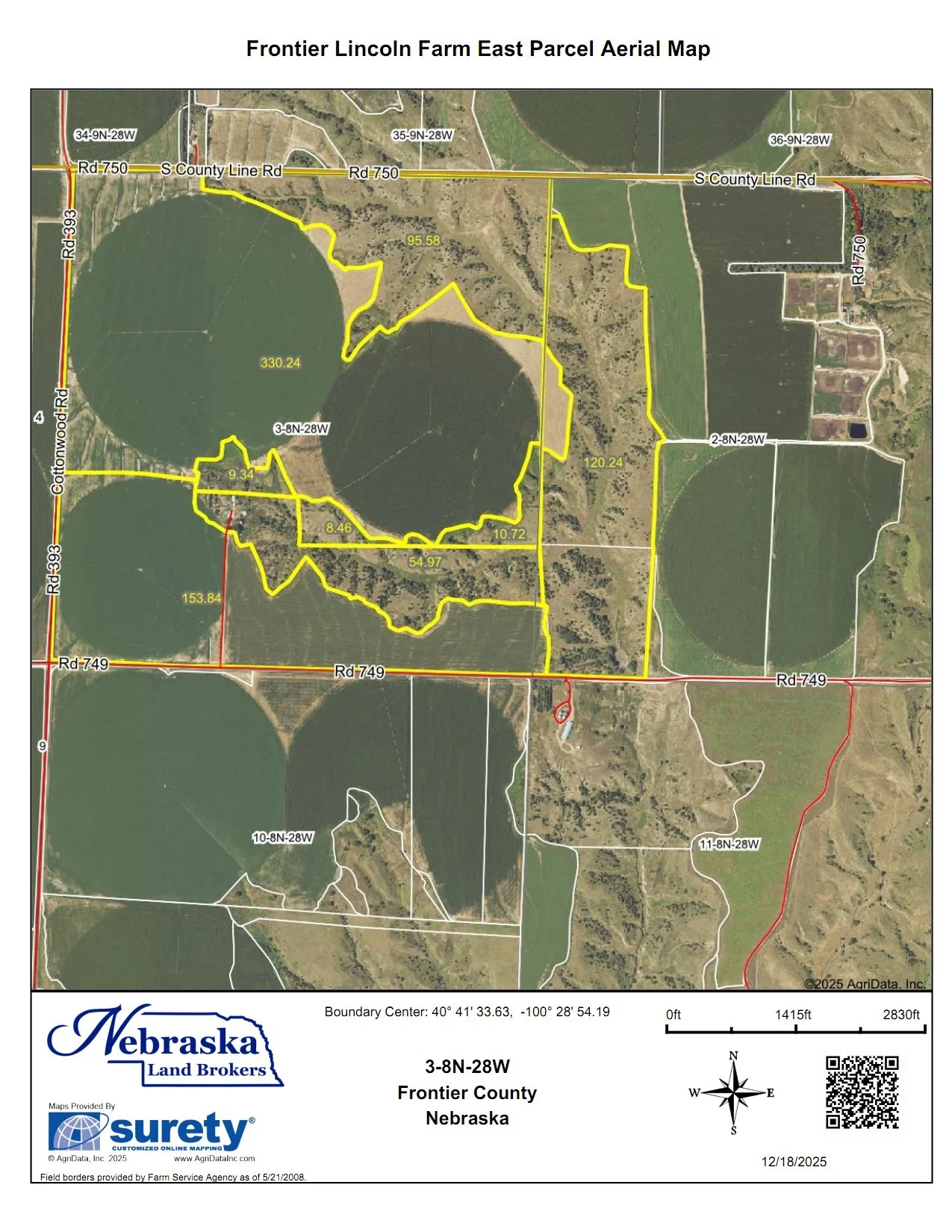
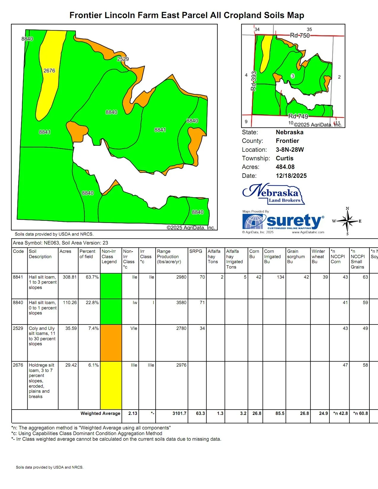
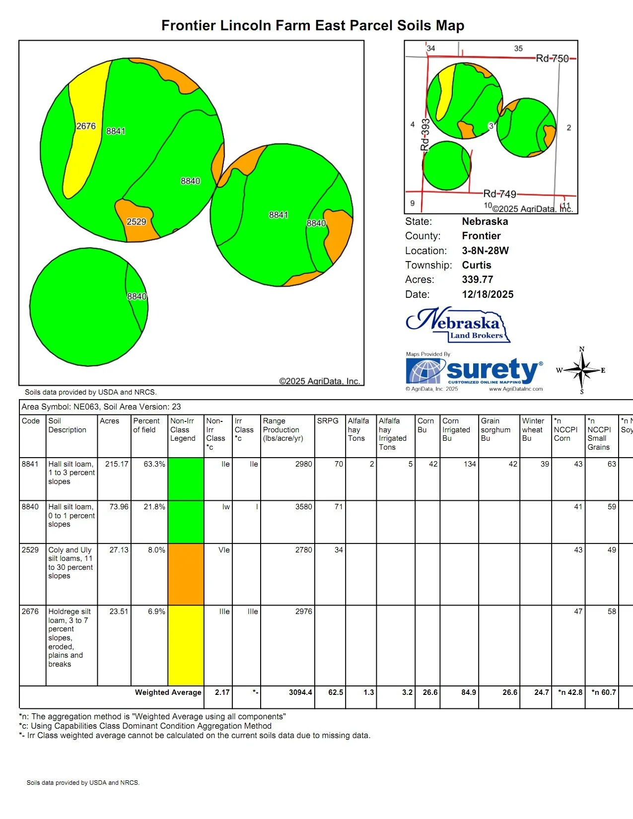
EAST PARCEL INFORMATION
Valley Center Pivot #4 in Section 3
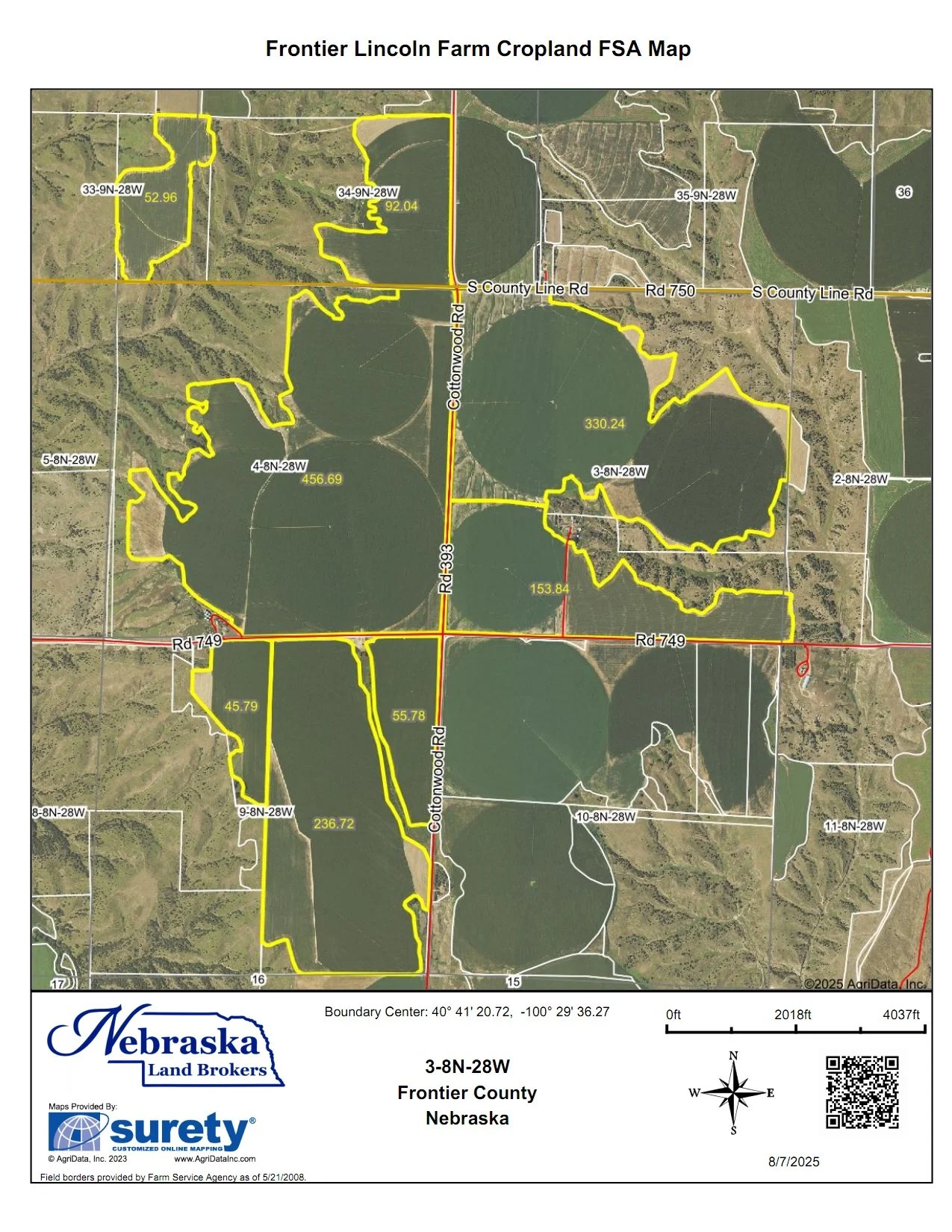
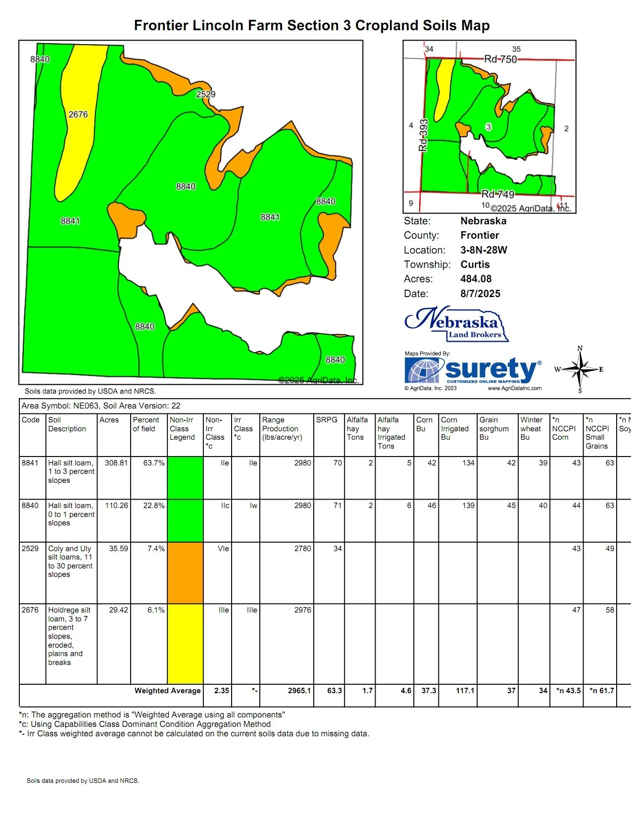
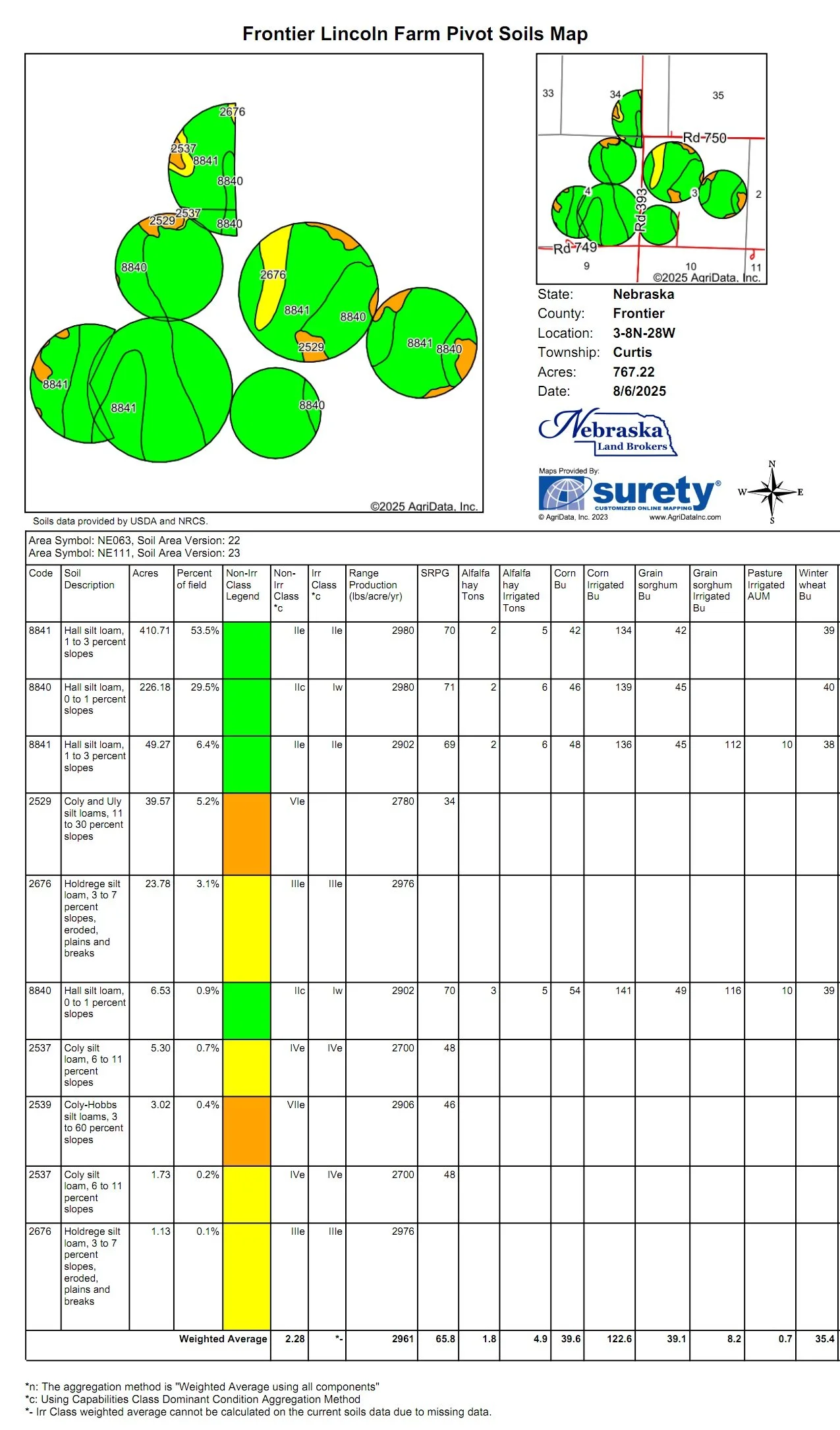
The East Parcel is all that land in Section 2 & 3-T8N-R28W of the 6th P.M., Frontier County NE. and includes 798.67 taxed acres. There is County Road access on the south, west and north.
There are 340 Middle Republican NRD certified irrigated acres in the Parcel. This Parcel will be offered with Well #3 of the Ownership. All of the certified irrigated acres are currently irrigated 3 Valley 8000 center pivot irrigation systems.
Registration # G-034782, drilled in 1971 to 540’ deep; static water at drilling 218’; pumping level at drilling 218’; pumping 2,568 gpm at drilling. 11” well with Western Land Roller irrigation pump set by Sargent Irrigation Oct 2014. Newman 200 HP electric motor, Micrometer flow meter indicated 1,280 gpm on July 29, 2025. Sargent Irrigation in Grant completed efficiency test and repaired 200 HP electric motor in Oct 2014. An pumping efficiency test was completed September 8, 2025 and the results of that test are available below.
Irrigation Well #3
The irrigation well is located across the road to the east in the E1/2 of Section 4. A well use agreement would be put in place for the use of this well for the life of the well.
The terrain of the cropland is level to gently rolling and the cropland soils are nearly 85% Class I & II Hall silt loams with 0-3% slopes.
PIVOT #3
NW 3-8-28 is a 2002 9 Tower Valley Model 8000, Serial # 10139587, total length is 1508 feet. 2018 V-Chart indicates 1000 GPM, 40 PSI
PIVOT #4
SW 3-8-28 is a 2002 5 Tower Valley Model 8000, Serial # 10143849, total length is 915 feet. 2018 V-Chart indicates 480 GPM, 30 PSI
PIVOT #5
NE 3-8-25 is a 2003 6 Tower Valley Model 8000, Serial # 10196991, total length is 1188 feet. 2018 V-Chart indicates 695 GPM, 36 PSI
Additionally the East Parcel does include a building site with a rental house that is a 1950 one story 1,839 sq ft house with 3 bedroom and 1.25 bathrooms. The site also includes a barn and steel shop building.
Fenced pasture extends east from the building site and wraps around the pivot on the south east and north. There is approximately 260 acres of rangeland with 2 stock water sites.
There is 152 acres of non-irrigated cropland with most of it being along the southern portion of the Parcel.
Acres: 798.67 taxed acres
MRNRD CIAs: 340 irrigated acres
Real Estate Taxes: 2025 real estate taxes are $20,610.20
MRNRD Occupational Taxes: $3,400
Legal Description: Township 8 North - Range 28 West of the 6th P.M., Frontier County, NE
Section 2: W1/2NW1/4; W1/2SW1/4
Section 3: All
LIST PRICE: $4,100,00.00
WEST PARCEL INFORMATION
Valley Center Pivot #6 in Section 4
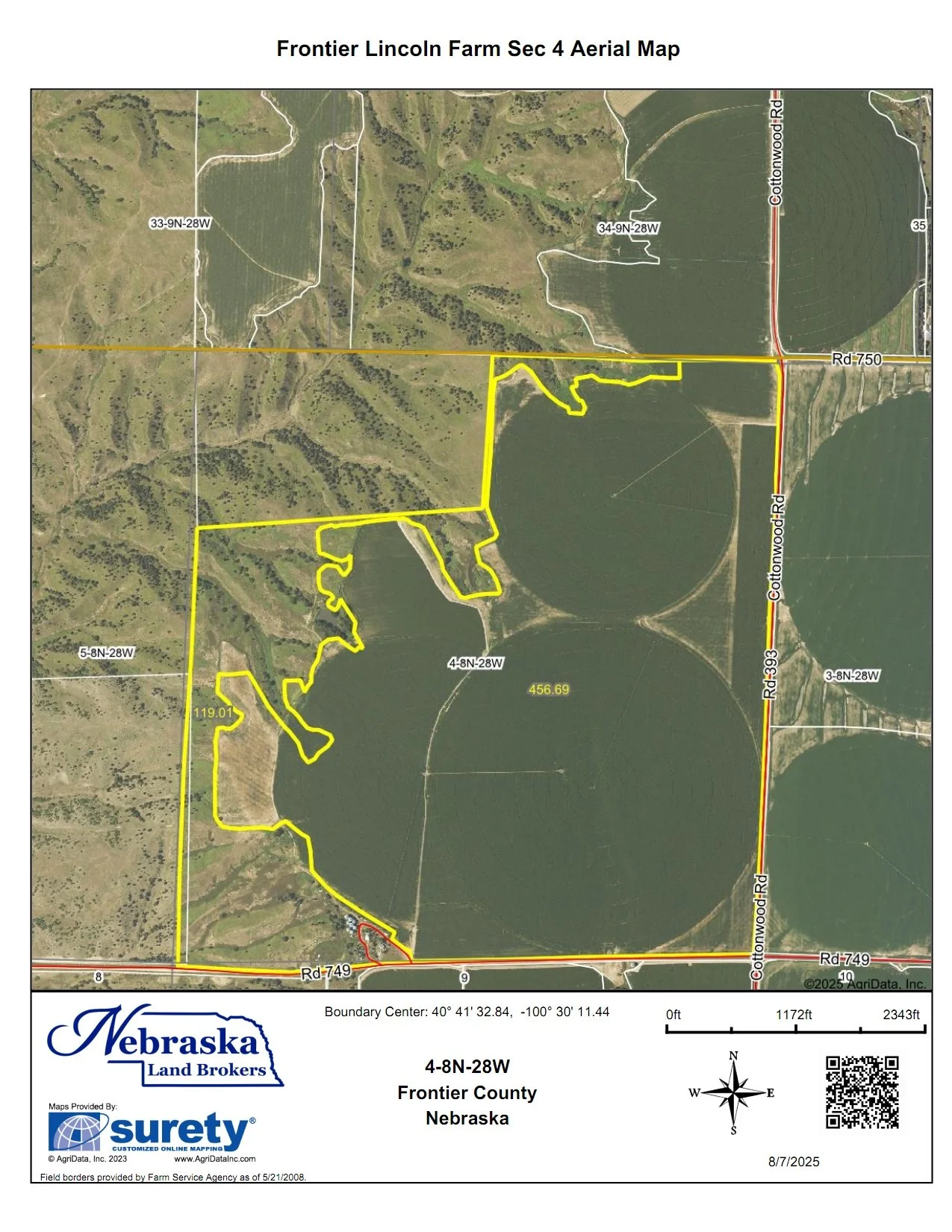
The West Parcel is all that land in Section 4-T8N-R28W of the 6th P.M., Frontier County NE. and Sections 33 & 34-T9N-R28W of the 6th P.M., Lincoln County NE. includes 900.98 taxed acres. There is County Road access on the south and east.
There are 511 Middle Republican NRD certified irrigated acres in the Parcel. The certified irrigated acres are currently irrigated with 4 Valley 8000 center pivot irrigation systems and gravity irrigated with gated pipe.
Irrigation Well 1 NWSE1/4 Section 4
Irrigation Well #1
Registration # G-027928, drilled in 1967 to 515’ deep; static water at drilling 20’; pumping level at drilling 285’; pumping 1,742 gpm at drilling. 10” well with Western Land Roller irrigation pump set by Sargent Irrigation June 15, 2004 set at 330’. GE 200 HP electric motor, Micrometer flow meter 20-01251-10 indicated 1,280 gpm on July 29, 2025. Sargent Irrigation in Grant overhauled pump in June 2004.
Irrigation Well 2 SESW1/4 Section 4
Irrigation Well #2
Registration # G-031385, drilled in 1969 to 528’ deep; static water at drilling 206’; pumping level at drilling 371’; pumping 2,150 gpm at drilling. 10” well with Western Land Roller irrigation pump set by Sargent Irrigation May 9, 2012 set at 400’. US Electric 200 HP RUSI Premium Efficiency electric motor new in August 2025, Micrometer flow meter 19-08895-10 indicated 890 gpm on July 29, 2025. Sargent Irrigation in Grant overhauled pump in May 1012. The 200 HP motor is new in August 2025.
PIVOT #1
SE 4-8-25 is a 2002 9 Tower Valley Model 8000, Serial # 10147704, total length is 1528 feet. 2018 V-Chart indicates 1020 GPM, 34 PSI
PIVOT #2
NE 4-8-28 is a 2002 6 Tower Valley Model 8000, Serial # 10147675, total length is 1124 feet. 2018 V-Chart indicates 560 GPM, 31 PSI
PIVOT #6
SW 4-8-28 is a 2015 7 Tower Valley Model 8000, Serial # 11119741, total length is 1321 feet . 2018 V-Chart indicates 900 GPM, 34 PSI
PIVOT #7
SE 34-9-28 is a 2015 7 Tower Valley Model 8000, Serial # 11119744, total length is 1426 feet. 2018 V-Chart indicates 960 GPM, 35 PSI. There is a booster pump at the pivot point of this pivot.
The West Parcel includes a building site with a 1969 one story 1,520 sq ft house with 3 bedrooms and 2 bathroom. It does have a partially finished basement.
There is nearly 200,000 bushel of grain storage at the building site and there is also a steel shop building at this site.
The pastureland on the West Parcel is located in the northern portion and fenced as one pasture with about 141 acres. The north pasture benefits from an electric submersible well and pipeline, which also supplies water to two neighboring operations. An additional stock tank provide water for stalk grazing, and the farm’s extensive unfenced rangeland offers valuable off-season forage.
FSA BASE INFORMATION: The complete Frontier Lincoln Farm is enrolled in PLC with 1,171 acres of FSA cropland base. 698.9 acres corn base with 167 bushel yield and 250 acres corn base with 159 bushel yield. 194.20 acres wheat base with 65 bushel yield and 19.40 acres wheat base with 47 bushel yield. 12.30 acres of grain sorghum base with 41 bushel yield and 3.20 acres of oats base with 41 bushel yield.
Should the farm be sold in Parcels the cropland base will be prorated by cropland acres with approval by the County Committee.
MIDDLE REPUBLICAN NATURAL RESOURCES DISTRICT
Irrigation Water Management
Frontier Lincoln Farm is located in the Middle Republican Natural Recourses District (MRNRD) which is responsible for the ground water management in the region. There is a limit to the amount of irrigation water that can be pumped that is set by the MRNRD. The current pumping restriction period is Jan 1, 2023 - Dec 31, 2027.
The irrigation wells on Frontier Lincoln Farm are pooled together for MRNRD management. They began the current period with 66.2 allocated inches to be pumped in the 5 year period. At the beginning of the 2025 growing season (the third year of the 5) there was 45.1 inches left in the last 3 years of the allocation period. Here is a MRNRD data sheet for complete information:
Here is a map of all Frontier Lincoln Farm’s MRNRD certified irrigated acres.
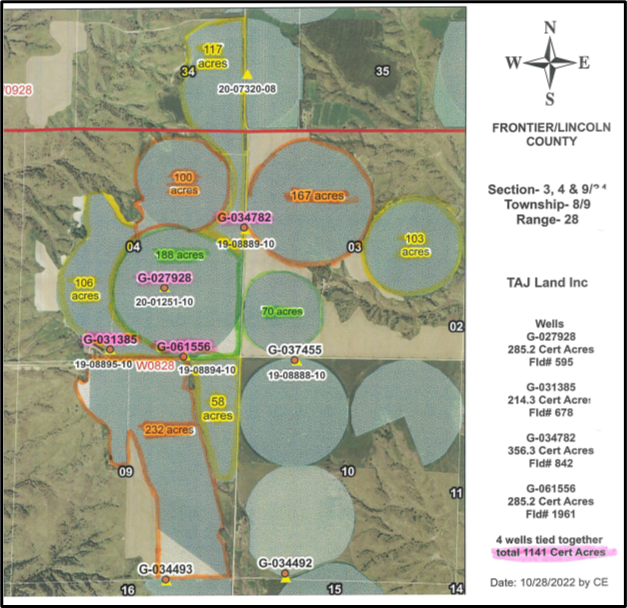
Frontier Lincoln Farm MRNRD CIA Map
ALL Frontier Lincoln Farm Valley Center Pivots
FRONTIER LINCOLN FARM COMPLETE FARM AERIAL IMAGES AND SOILS MAPS FOR REFRENCE


For more information or to schedule a tour of this opportuntiy, Call or Text:
Duane McClain, Listing Broker - 308.530.0221
Ed Vontz, Associate Broker - 308.520.3953
Butch Burge, Associate Broker - 308.882.1925
Ariel Fanning, Sales Associate - 308.350.0483


BUYER'S BROKERAGE COOPERATION DISCLAIMER: When purchasing a property listed by Nebraska Land Brokers, LLC, if a Buyer has a Buyer's Broker, the Buyer Broker must be identified upon initial contact with Nebraska Land Brokers, be present at the initial showing of the property and be actively participating in the presenting of offers in order to participate in a real estate commission cooperation, if any is available. If these conditions are not met, compensation to a Buyer’s Broker, will be at the discretion of Nebraska Land Brokers, LLC.

